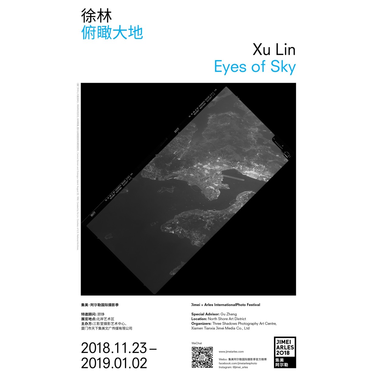
• XU LIN EYES OF SKY 1950’S AND 1960’S AERIAL PHOTOS OF SOUTHEASTERN COASTAL CITIES OF CHINA SPECIAL ADVISOR: GU ZHENG...

    XU LIN

    EYES OF SKY

    1950’S AND 1960’S AERIAL PHOTOS OF SOUTHEASTERN COASTAL CITIES OF CHINA

    SPECIAL ADVISOR: GU ZHENG

    The confrontations between the East and the West deepened in the late 1950s and 1960s, when the Cold War was at its peak. In order to obtain information on military and economics, various U.S. agencies used any possible means to collect intelligence on China, including aerial and satellite surveillances. The U-2 high altitude reconnaissance airplane, designed and manufactured by Lockheed Corporation, was the most important image collecting platform of the period.

    Between 1957 and 1967, over 100 reconnaissance missions were successfully flown over China, covering from Xinjiang and Tibet to Heilongjiang and Hainan Island. Every mission covers as much as tens of thousands of square kilometers of land, including large number of densely populated regions and majority of mid to large size cities. Restricted by technology and funding, land surveys in China were mostly done on the ground between 1950 and 1980. Limited amount of aerial and satellite imagery were collected, and most are still unavailable to the public. The landscape changed greatly since 1980 under the pressures from development, population growth and urbanization. Images collected by various U.S. agencies are precious resources in the study of China’s changes of landscape, urbanization, economics, defense industry and remote sensing archaeology.

    In 2007, Xu Lin, a Chinese engineer who moved to the United States in the early 1990’s, learned that film from the Lockheed U-2 reconnaissance aircraft had been declassified and given to the U.S. National Archives. What started with a search for images of his hometown in China grew into a devouring obsession. To show the country’s past to the public, Xu Lin has copied hundreds of U-2 images over the past ten years, driving eight hours from his home near Boston, to the National Archives’ research facility in Maryland. The images selected for this exhibition are Cold War period U-2 reconnaissance and satellite images of Beijing and South Eastern Coastal cities: Xiamen, Shanghai, Nanjing, Hangzhou, Fuzhou, Guanzghou, Hong Kong and Macao.

    Original declassified films courtesy of U.S. National Archives.

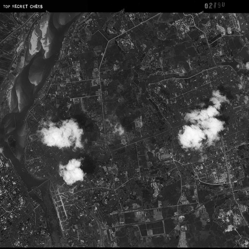
  • Hangzhou Railway Station. From the exhibition Eyes of Sky - 1950’s and 1960’s Aerial Photos of Southeastern Coastal Cities of China, proposed by Xu Lin. Courtesy of U.S. National Archives.

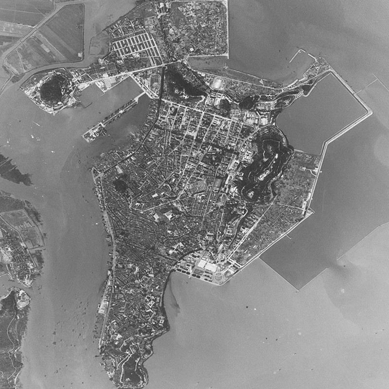
  • Macau. March 26, 1962. Mission Pilot Tiger Wang. From the exhibition Eyes of Sky - 1950’s and 1960’s Aerial Photos of Southeastern Coastal Cities of China, proposed by Xu Lin. Courtesy of U.S. National Archives.


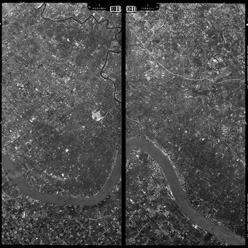
  • Central Shanghai and Pudong, July 7, 1964. Mission Pilot Johnny Wang, ROCAF. From the exhibition Eyes of Sky - 1950’s and 1960’s Aerial Photos of Southeastern Coastal Cities of China, proposed by Xu Lin. Courtesy of U.S. National Archives.

  • XU LIN Born 1961, Jilin, China. Lives and works in Boston, Massachussets, USA. After having graduated from Colorado State University...

    XU LIN

    Born 1961, Jilin, China. Lives and works in Boston, Massachussets, USA.

    After having graduated from Colorado State University with a Master's degree in digital image processing in 1993, Xu Lin worked on the state of the art digital development for Eastman Kodak between 1995 and 2006, later serving as technical director for LandAirSea Systems, Inc in the United States. In 1996, he began work on collecting images taken by image-collecting satellites and aircraft during the Cold War. Due to this groundbreaking research on U-2 reconnaissance plane imaging at the National Archives, the May 2012 issue of the American Air Sensing Air & Space Smithsonian contained a special introduction of Xu Lin's project. In addition, Xu Lin has lectured at institutions including the National Archives of the United States and the Smithsonian National Air and Space Museum in Washington. At present, his main research direction is U-2 and A-12/SR-71 high-altitude reconnaissance aircraft during the Cold War, Firebee series UAV, Keyhole series KH-4, KH-7 and KH-9 reconnaissance satellite platforms in China. Xu Lin was assisted in the remote sensing archaeology image collection and research work at Harvard University's Department of Anthropology, the National Museum of China, the Department of Archaeology of Wuhan University and the Chinese University of Hong Kong.


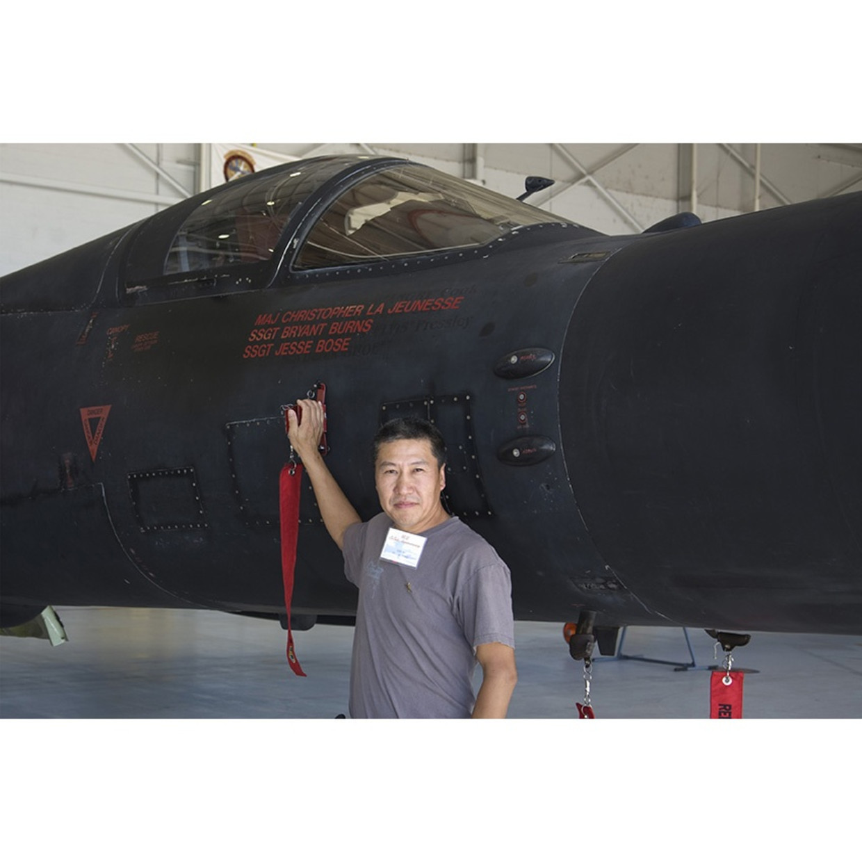
    Image: Xu Lin. Behind him is a USAF U-2S, tail numbered 68-10329 and still in active service. This aircraft has flown reconnaissance missions along the Chinese coast between the late 1960s and early 1970s. Photo taken in 2010.

  • GU ZHENG Born in 1959, Ph.D. (Osaka Prefecture University, Japan, 1998), Professor of the School of Journalism, Fudan University, Vice-director...

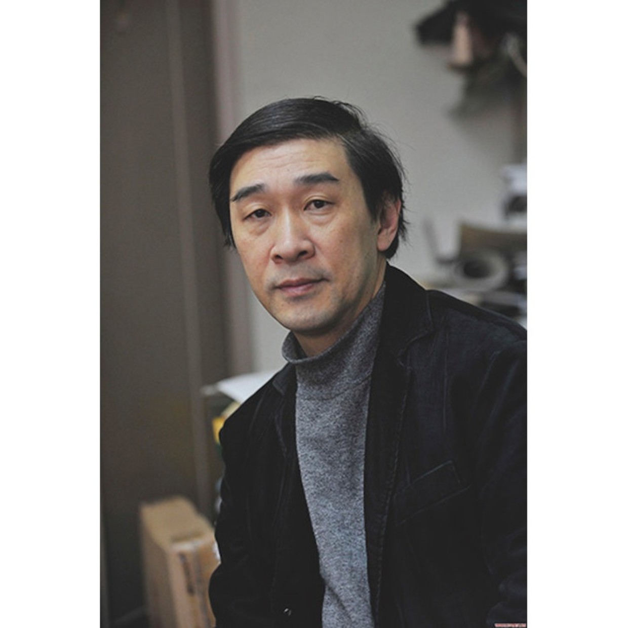
    GU ZHENG 

    Born in 1959, Ph.D. (Osaka Prefecture University, Japan, 1998), Professor of the School of Journalism, Fudan University, Vice-director of the Research Center for Visual Culture, Fudan University. A member of the editorial committee of Chinese Photography (Beijing), a contributing editor for Aperture (New York), a member of editorial board of European Photography (Berlin). He lives and works in Shanghai, China.

    Gu has published several books about contemporary photography and photographic history, including No Truth Behind All Truth: The Practices of 20th Century Modern Photography (2002), Expression of the City: 20th Century Urban Photography (2003), The Sixth Face of Modernity (2008), Conceptual Street (2010), Chinese Contemporary Photography (2011), and Photographer, who is on the Road (2013).

    He has curated many exhibitions such as Miao Xiaochun: A Visitor From The Past (Epsite Gallery, Beijing and Shanghai, 2004), Documenting China (Bates College Museum of Art, Maine and China Institute, NY, USA, 2004), Between Reality and Memory (Parsons School of Design, New School University, NY, USA, 2004), 2005 Guangzhou International Photography Biennale: Reviewing The City (Guangdong Museum of Art, 2005), Chinese Urban Documentary Photography (Institute for the Humanities, University of Michigan, USA, 2005), Harvest: 1st Chinese Photography Exposition (Art Scene China, 2005), Harvest: 2nd Chinese Photography Exposition (Art Scene China, 2006), Developing China 20 Years of Chinese Contemporary Photography (Nanjing Square Gallery, Nanjing, 2006), Will to Height: Contemporary Art Exhibition (Epsite Gallery, Shanghai, 2010), Aura & Post Aura: 1st Beijing Photo Biennial (Contemporary Art Museum of The China Millennium Monument, Beijing, 2013).

    He was the winner of the Chinese Photography Golden Figure Prize (Theory and Criticism) in 2001 and the 1st Shafei Photography Award (2007). He is a jury member of World Press Photo (2013).